Mountain Bike
Trails
According to Casey
*This site is
currently
under construction, so please bear with me...*
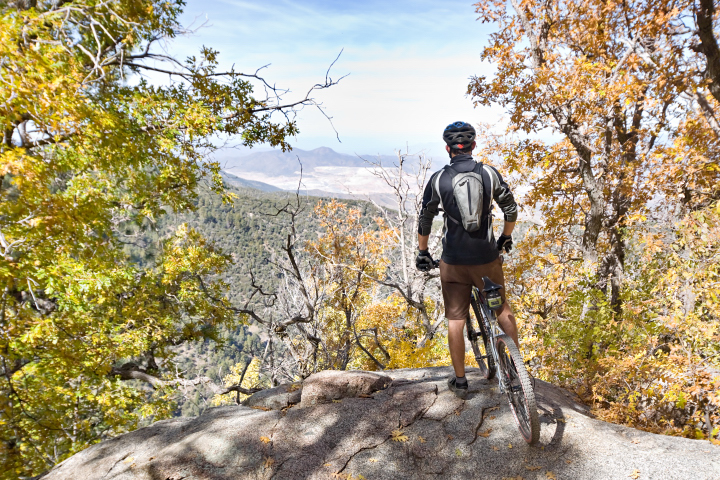
Flagstaff
Area Trails
This is some of the best singletrack I've ever ridden. Riding season is
late spring to early fall, and there's something for everyone, although
beginners
should use extreme caution. To reach these Flagstaff area trails,
travel
North out of Flagstaff on HWY 180, turn right on Schultz Pass Road,
fork
left (right is Mt. Elden Lookout Road), and as the road turns to dirt,
look
to the right for a the parking area. All of these trails are accessible
from
this point. There is a map of the trail system at the end of the
parking
area.
Schultz
Creek Trail
This is gem of a trail. It's about 5 miles long (about 10 round-trip),
and
all down-hill (after climbing up! ha-ha). Most riders treat it as an
out
and back ride, beginning at the trail head parking area. This hard pack
trail
winds and twists through the forest along side and sometimes, across
Schultz
Creek (which is usually dry). It is a low-slope climb out until you
reach
an open camping area. Turn around, put it in the big ring and hang on
to
your bars! There are some rocks and other surprises so pay attention
and
keep it under control! Brush-up on your reflexes and watch for other
riders,
hikers, dogs, horses, and motorcycles. Yes, this is the one trail in
the
system open to motorcycles. This is a good trail to get acquainted with
the
area terrain.
This is the entire trail. The video smooths-out and picks-up about a minute in...
Catwalk
and Sunset Trails
This is about as good as it gets. I connect these in a counter
clockwise
direction, and although purists will give you a hard time, I suggest a
shuttle
to the top of Mt. Elden, but only so that you can conserve the time and
energy
to ride it more than once. Otherwise, your a wuss. This ride is less
than
10 miles (with a connection with Schultz Creek trail), and probably
won't
take 30 minutes to complete. It's fast. The 7 mile ride to the top on
Mt
Elden Lookout Road, however, will take most at least an hour, and uses
a
lot of energy. For most people, doing this ride twice in a day would be
out
of the question. If you look at a map, you will probably notice Upper
Oldham
trail which appears to cut a couple of miles from the ride up, but
don't
be fooled as I was! Although it may be possible to ride up this trail,
most
will find themselves toting their bikes up the seemingly endless,
rocky,
switchbacks. Resist the urge, just take the road. When you reach the
top,
look to the left. As the trees end, follow the wide car path that leads
to
a singletrack trail. This is where the fun begins. As you head north,
you'll
notice a pretty serious drop to your right, and you can see for miles
to
the East. It's mostly (one short climb) downhill from here. Pay
attention
and watch for other trail users.
Little
Bear Trail
Once again, another trail as near perfection as I've ridden. While
Sunset
trail is almost entirely downhill, it is short. If you want to put in
some
mileage on the mountain, take a right on Little Bear about half-way
through
Sunset. There is a sign, you shouldn't miss it. Prepare to rip down the
backside
of the mountain through miles of forest switchbacks, gliding over rocky
sections,
whizzing through ponderosa pine. At the lowest point you'll come to an
intersection,
take the left. At this point the trail climbs and drops for a while,
until
you reach Schultz Creek Trail.
This is Catwalk, Sunset and Little bear strung together. Skip from 1:30-5:30 as bumps, bright sun and shadows make it a little difficult to watch. starting at 5:30 is Little Bear; pretty good stuff.
Rocky
Ridge Trail
Some say I'm sick, but I enjoy really technical climbs. Thus, Rocky
Ridge
is one of my favorites. Most ride it downhill from Lookout road, but I
like
to take it uphill from the aforementioned parking area (south, more or
less)
to connect with Oldham, or return back down. This short (3 miles),
low-slope
single track is strewn with rocks and boulders, giving you a chance to
really polish your trials skills. It is entirely ridable, so if you
enjoy this
sort of thing, don't be intimidated. Be careful though.
Lower
Oldham Trail
This another fun trail. I like to connect it as the last trail in a
Catwalk,
Sunset, Little Bear, Schultz Creek, Rocky Ridge combination, ending in
town.
From Mt. Elden Lookout Road, It rolls and winds through the forest on
hardpack
single track and can be combined in many ways (as with any of these
trails)
with the other trails in the system to make some great rides. It is
also
a good get-acquainted trail for the area terrain.
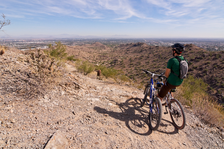
Valley
(Phoenix Area) Trails
Rocks, cacti and cholla. This area looks rugged and unforgiving, and
is,
well, rugged and unforgiving, but that doesn't mean the trails in this
area
are not fun to ride. Be careful and know the limits to your skill
level,
as there is little room for error on rocks and gravel, and inevitably
there
will be a jagged rock or a plant of a prickly nature waiting in your
path
of doom. Riding season is early fall to late spring, and summer for
early
risers or night riders. I don't advise riding in the summer between 9
AM
and 8 PM, as the sun is unforgiving, and there is no shade in the
desert.
Flats will happen, pinch or puncture, so carry at least on extra tube
and
a pump, as well as the other usual tools, and most importantly, bring
plenty
of water and common sense, this is the desert after all!

South
Mountain Park
This is supposedly the largest municipal park in the world, and has
much
to offer mountain bikers of all skill levels. Although there are many
trail
choices in this area, two in particular stand out as must-rides during
one's
visit to the Valley. As described, they begin at the Pima Canyon
parking
area, at the east end of the mountain. From I-10 take Elliot road west
to
48th Street, turn right. When 48th appears to make a hard curve right,
look
for the South Mountain Park signs to the left. Turn left, and before
you
enter the neighborhood, take another left and enter the park. Parking
is
along the park road and at the end of this road.
Dessert
Classic Trail (South Mountain Park)
This is a great ride for all skill levels, as it wanders along the
generally
smooth southern foothills of the park. As an out and back ride from the
east
end of the park, it offers about 19 miles of fast roller coaster
singletrack
on varying terrain with about 1000' of elevation gain. The second half
of
the trail is a little more technical (rocky) than the first, which,
coupled
with the extra mileage, causes many to turn around at the water tank,
which
is about the halfway point. The trail head is on the left (south) side
of
the parking lot.
National
Trail (South
Mountain
Park)
One of my personal favorites, this one
isn't
for beginners. It's made up of rocks, steps and drops, connected by
some
of the best singletrack I've ridden. The most popular section is short
(about
5 miles, one way), and as an out-and-back ride is quite a workout. The
ride
out is a climb, from about 1300' to about 2500'. If that's not enough,
it's
technical (but fun!). About the second time you think you can't take
anymore,
you reach the top of the pass. From here you can turn around or drop
down
to a parking area, which is a fun descent, but you've got to go back
up;
more punishment. The ride back is a hoot. It's all hop, drop, and swoop
from
here. Be careful! This trail can be dangerous, and on the weekends,
strewn
with hikers. Stay in control and be courteous to other users. To find
the
trail, follow the dirt road (closed to vehicles) at the west end of the
parking
area for about 1-1/4 miles. at the end of the road, look to your right
for
the signed trail head, and drop into the wash. When you reach an
intersection,
there is a decision to make. To the left is National, right is Mormon
loop.
They come back together about half-way, and Mormon is an easier climb,
but
National is more fun. Just be sure to come back on National. Another
option
is to take Desert Classic around the south side of the mountain, up
Telegraph
pass (nasty), then take the national trail back. This will give you an
opportunity
to ride more of the National trail. It can also be ridden in the
opposite
direction.
Phoenix
Mountain
Preserve
Due to it's central
location
to the valley, this is one of the most popular areas in the valley for
mountain
biking, hiking, and yes, equestrian use. It can be accessed from HWY 51
via
Northern Ave., or Shea Blvd via 40th St. There is a network of trails
here,
with many custom loop options, but Trail 100 is the main and
longest
trail. There is something for everyone, but the trails are
predominately
intermediate. Like most of the trails in the valley, these can also be
rugged
and dangerous. There are so many trail choices that I would suggest
finding
a map of the area with difficulty levels for those concerned. Maps can
usually
be found at local bike shops, and are easy to follow, as the trails in
this
system are well marked.
Pima-Dynamite Trails
The
rollercoaster-like
trails beginning north-east of the intersection of Pima Road and
Dynamite
Blvd. in north Scottsdale offer some incredibly fun and scenic riding.
There
are so many trail choices and intersections that all I can say is, get
a
map! It is real easy to get lost out there. My favorite loop is a
combination
of "Dare A Sarah" (out) and "West Express" (return). What ever you do
out
there,
be very careful. This area is also very popular with the dirtbike
and
ATV crowd. Be courteous, it is much easier for you to stop and move out
of
the way than it is for them, and should you meet one of these machines
on
the trail the hard way, guess who wins - not you! Pay close attention
and
always keep an ear open for motors and an eye for dust trails in the
distance.
Difficulty levels range from beginner (stick to the jeep trails) to
expert. The terrain closest to the parking area is mostly rolling hard
dirt and
granite
with some sandy wash crossings. This is State Trust Land, and a permit
is
required (though I've never known anyone to have one...).
Pass
Mountain Trail
Located in the Usery Mountain Recreation
Area
in north-east Mesa, This 8 mile trail is not for the weak of heart,
lung,
leg, or anything else for that matter. In fact, a sign at the trailhead
says
"not recommended for bicycles". None the less, in my opinion it is one
of
the best in the valley; it will exercise your endurance, strength, and
skills,
while rewarding you with spectacular scenery and butt-puckering fun.
The
trailhead can be reached by entering the park from Usery Pass Road
(entry
fee required), or by parking at the east end of McKellips Road (bring a
couple
of dollars), and entering from the Levee Trail. If you enter from
McKellips,
be mindful of the the "no parking" areas, they're serious! Turn east on
the
Levee Trail, then after about a half mile, turn north on a trail of
which
I cannot recall the name. Continue north until you come to a parking
area,
then continue north on pavement until you reach the trail head. You'll
want
to ride this trail in a clockwise direction. The trail starts off
friendly
enough, but quickly becomes a technical, yet entertaining climb (about
900')
that will keep you in your granny gear. Once you approach the backside
of
the mountain the trail levels off a bit, winding and rolling along the
north-east
side of Pass Mountain, with incredible views to your left (and a nasty drop, so watch the trail, or take a
moment
to take it in). Once you reach the pass, it turns DOWN hill from here.
Beware
that the trail is composed of loose and jagged rocks waiting to pinch a
tube
or impale a body part, so be extra careful, and watch for hikers! This
trail
is very popular for hikers, and since few bikers make this loop, hikers
aren't
watching for you. At one point during the descent the trail will split,
but
regardless which direction you choose, it will converge again shortly.
When
the trail levels off it will begin to turn west again, then north,
bringing
you back to the trailhead. At this point, return to the levee trail
system via pavement.
McDowell Mountain Park
McDowell Mountain
Park
is located north of Fountain Hills on McDowell Mountain Road. The
trails
in the park are mostly hard dirt, and intermediate in nature. There are
no
major steep climbs, and due to it's somewhat remote location and
entrance
fee, is typically not overcrowded compared to the municipal parks.
Competitive Loops
(McDowell Mountain Park)
There are 3 loops near the entrance (to the
left) that are for competitive events and training. The "Long" loop is
about
8 miles long, the "Sport" and "technical" loops are about 3 miles each,
and
are all fun intermediate rides. These can also be combined for custom
loops.
Pemberton
Trail (McDowell
Mountain Park)
Parking for this trail is at the end of
Shallmo
Drive. This trail is a nice long one, about 17 miles, and is an
intermediate
ride. The trail is generally smooth (except for a few places) and
rolling,
and quite scenic. I prefer to ride counter clockwise, saving my energy
for
the singletrack when the trail turns south, which, if you are in good
enough
shape to keep your momentum up, can be a blast.
Check back, much more to come...